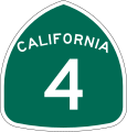
Datei:California 4.svg

Größe der PNG-Vorschau dieser SVG-Datei: 385 × 401 Pixel. Weitere aus SVG automatisch erzeugte PNG-Grafiken in verschiedenen Auflösungen: 230 × 240 Pixel | 461 × 480 Pixel | 737 × 768 Pixel | 983 × 1.024 Pixel | 1.966 × 2.048 Pixel
Originaldatei (SVG-Datei, Basisgröße: 385 × 401 Pixel, Dateigröße: 9 KB)
Dateiversionen
Klicke auf einen Zeitpunkt, um diese Version zu laden.
| Version vom | Vorschaubild | Maße | Benutzer | Kommentar | |
|---|---|---|---|---|---|
| aktuell | 17:14, 20. Mär. 2006 |  | 385 × 401 (9 KB) | SPUI~commonswiki | |
| 14:27, 20. Mär. 2006 |  | 385 × 401 (9 KB) | SPUI~commonswiki | {{spuiother}} 24 in by 25 in (600 mm by 635 mm) California State Route shield, made to the specifications of the [http://www.dot.ca.gov/hq/traffops/signtech/signdel/specs/G28-2.pdf 1971 Caltrans sign drawing] (still in use). Uses the [http://www.triskele. |
Dateiverwendung
Die folgenden 2 Seiten verwenden diese Datei:
Globale Dateiverwendung
Die nachfolgenden anderen Wikis verwenden diese Datei:
- Verwendung auf da.wiki.x.io
- Verwendung auf en.wiki.x.io
- Alpine County, California
- Calaveras County, California
- Contra Costa County, California
- San Joaquin County, California
- Stanislaus County, California
- Northern California
- Pacific Crest Trail
- Interstate 680 (California)
- California State Route 99
- California State Route 160
- California State Route 49
- California State Route 3
- Eastern California
- California State Route 4
- Yellow Line (BART)
- Wikipedia:WikiProject U.S. Roads/Redirects/California
- Pittsburg/Bay Point station
- California State Route 88
- California State Route 89
- Ebbetts Pass
- California State Route 242
- Transportation in the San Francisco Bay Area
- List of highways numbered 4
- Interstate 80 in California
- California State Route 207
- User:Gateman1997/Highways
- Interstate 5 in California
- Template:Yellow Line (BART)
- U.S. Route 395 in California
- List of state highways in California
- User:Timsabin/List of HOT and ETL lanes in the United States
- California county routes in zone E
- California county routes in zone J
- List of Sierra Nevada road passes
- Template:Infobox road/testcases/USA
- Vasco Road
- EBART
- List of mountain passes in California
- Template:Routelist row/testcases
- Template:EBART
- Template:Routelist row/testcases/base
- Template:Pittsburg/Bay Point station
- User:Ejells2/sandbox
- User:Tv's emory/Sandbox/List of state highways in California
- Stockton Diamond
- Template:Stockton Diamond
- Ygnacio Valley Road
- Template:Pacific Crest Trail
Weitere globale Verwendungen dieser Datei anschauen.
