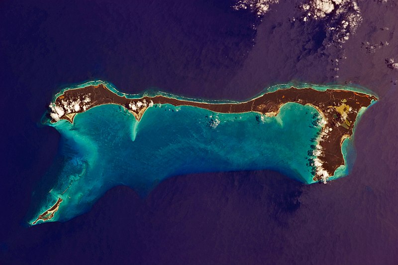
Datei:Cat Island, Bahamas.JPG

Größe dieser Vorschau: 800 × 532 Pixel. Weitere Auflösungen: 320 × 213 Pixel | 640 × 426 Pixel | 1.024 × 681 Pixel | 1.280 × 852 Pixel | 2.560 × 1.703 Pixel | 4.256 × 2.832 Pixel
Originaldatei (4.256 × 2.832 Pixel, Dateigröße: 6,61 MB, MIME-Typ: image/jpeg)
Dateiversionen
Klicke auf einen Zeitpunkt, um diese Version zu laden.
| Version vom | Vorschaubild | Maße | Benutzer | Kommentar | |
|---|---|---|---|---|---|
| aktuell | 11:37, 21. Mär. 2011 |  | 4.256 × 2.832 (6,61 MB) | Originalwana | {{Information |Description ={{en|1=Like most other islands in the Bahamas, Cat Island is located on a large depositional platform that is composed mainly of carbonate sediments and surrounding reefs. The approximately 77 kilometre-long island is the pa |
Dateiverwendung
Die folgende Seite verwendet diese Datei:
Globale Dateiverwendung
Die nachfolgenden anderen Wikis verwenden diese Datei:
- Verwendung auf ar.wiki.x.io
- Verwendung auf arz.wiki.x.io
- Verwendung auf az.wiki.x.io
- Verwendung auf ca.wiki.x.io
- Verwendung auf ceb.wiki.x.io
- Verwendung auf cs.wiki.x.io
- Verwendung auf de.wikivoyage.org
- Verwendung auf el.wiki.x.io
- Verwendung auf en.wiki.x.io
- Verwendung auf es.wiki.x.io
- Verwendung auf fi.wiki.x.io
- Verwendung auf fr.wiki.x.io
- Verwendung auf gl.wiki.x.io
- Verwendung auf he.wiki.x.io
- Verwendung auf it.wiki.x.io
- Verwendung auf ko.wiki.x.io
- Verwendung auf lt.wiki.x.io
- Verwendung auf nl.wiki.x.io
- Verwendung auf no.wiki.x.io
- Verwendung auf pl.wiki.x.io
- Verwendung auf pt.wiki.x.io
- Verwendung auf ro.wiki.x.io
- Verwendung auf www.wikidata.org
- Verwendung auf zh.wiki.x.io

