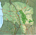
Datei:Cederberg LM topographic map.svg

Größe der PNG-Vorschau dieser SVG-Datei: 614 × 600 Pixel. Weitere aus SVG automatisch erzeugte PNG-Grafiken in verschiedenen Auflösungen: 246 × 240 Pixel | 491 × 480 Pixel | 786 × 768 Pixel | 1.049 × 1.024 Pixel | 2.097 × 2.048 Pixel | 1.113 × 1.087 Pixel
Originaldatei (SVG-Datei, Basisgröße: 1.113 × 1.087 Pixel, Dateigröße: 9,7 MB)
Dateiversionen
Klicke auf einen Zeitpunkt, um diese Version zu laden.
| Version vom | Vorschaubild | Maße | Benutzer | Kommentar | |
|---|---|---|---|---|---|
| aktuell | 15:14, 29. Mai 2021 |  | 1.113 × 1.087 (9,7 MB) | Htonl | Restore previous changes + minor roads |
| 14:42, 29. Mai 2021 |  | 1.113 × 1.087 (9,71 MB) | Htonl | Add minor roads | |
| 11:00, 20. Nov. 2020 |  | 1.113 × 1.087 (9,46 MB) | Htonl | stop the validator from complaining about aria-label tags | |
| 10:24, 20. Nov. 2020 |  | 1.113 × 1.087 (9,46 MB) | Htonl | correct N2 label to N7 | |
| 08:43, 18. Jun. 2019 |  | 1.113 × 1.087 (9,46 MB) | Htonl | Add Wupperthal | |
| 22:49, 17. Jun. 2019 |  | 1.113 × 1.087 (9,45 MB) | Htonl | {{Information |Description ={{en|1=Topographic map of the Cederberg Local Municipality in South Africa.}} |Source ={{own}} |Author =Htonl |Date =2019-06-17 |Permission ={{self|cc-by-sa-3.0}}{{ODbL OpenStreetMap}} |other_versions = }} Category:Maps of local municipalities of the Western Cape |
Dateiverwendung
Die folgende Seite verwendet diese Datei:
Globale Dateiverwendung
Die nachfolgenden anderen Wikis verwenden diese Datei:
- Verwendung auf en.wiki.x.io
- Verwendung auf www.wikidata.org
