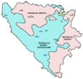
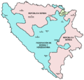
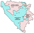
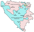
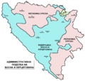
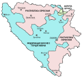
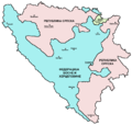
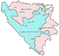
Datei:Map Bih entities.png

Größe dieser Vorschau: 633 × 599 Pixel. Weitere Auflösungen: 254 × 240 Pixel | 507 × 480 Pixel | 811 × 768 Pixel | 1.103 × 1.044 Pixel
Originaldatei (1.103 × 1.044 Pixel, Dateigröße: 67 KB, MIME-Typ: image/png)
Dateiversionen
Klicke auf einen Zeitpunkt, um diese Version zu laden.
| Version vom | Vorschaubild | Maße | Benutzer | Kommentar | |
|---|---|---|---|---|---|
| aktuell | 22:38, 6. Jul. 2010 | 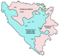 | 1.103 × 1.044 (67 KB) | WikiEditor2004 | Reverted to version as of 23:51, 12 March 2010 - I do not agree that these are better colours. it is subjective opinion and it is bad idea that every user should upload new file version because he have different opinion about "better" colours |
| 13:26, 6. Jul. 2010 |  | 1.103 × 1.044 (58 KB) | Mostarac | better colors | |
| 13:25, 6. Jul. 2010 |  | 1.103 × 1.044 (58 KB) | Mostarac | better colors and cities. | |
| 00:51, 13. Mär. 2010 |  | 1.103 × 1.044 (67 KB) | Dungodung | Well, I beg to differ. This one shows cities and is of better quality | |
| 12:55, 9. Mär. 2010 |  | 700 × 615 (172 KB) | Mostarac | revert, bolje boje! | |
| 22:10, 20. Dez. 2009 |  | 1.103 × 1.044 (67 KB) | WikiEditor2004 | improved version | |
| 09:05, 16. Jul. 2007 |  | 700 × 615 (13 KB) | Nihad Hamzic | This image was once a JPEG, the author had simply directly converted it to JPEG. I have grealty optimised its size by removing JPEG artifacts, and reducing color domain. | |
| 23:42, 28. Jan. 2006 |  | 700 × 615 (172 KB) | (:Julien:) | Map of the 2 entities of the BiH and the Brčko district, author: en:User:PANONIAN, source: en:Image:M_bih03.png, PANONIAN is the creator and released it under PD. Category:Bosnia and Herzegovina |
Dateiverwendung
Die folgende Seite verwendet diese Datei:
Globale Dateiverwendung
Die nachfolgenden anderen Wikis verwenden diese Datei:
- Verwendung auf af.wiki.x.io
- Verwendung auf ami.wiki.x.io
- Verwendung auf am.wiki.x.io
- Verwendung auf arc.wiki.x.io
- Verwendung auf ar.wiki.x.io
- Verwendung auf arz.wiki.x.io
- Verwendung auf ast.wiki.x.io
- Verwendung auf az.wiki.x.io
- Verwendung auf bat-smg.wiki.x.io
- Verwendung auf be-tarask.wiki.x.io
- Verwendung auf bi.wiki.x.io
- Verwendung auf bjn.wiki.x.io
- Verwendung auf bn.wiki.x.io
- Verwendung auf bn.wikivoyage.org
- Verwendung auf bo.wiki.x.io
- Verwendung auf bpy.wiki.x.io
- Verwendung auf br.wiki.x.io
- Verwendung auf bs.wiki.x.io
- Verwendung auf ca.wiki.x.io
- Verwendung auf ceb.wiki.x.io
- Verwendung auf ce.wiki.x.io
- Verwendung auf ckb.wiki.x.io
- Verwendung auf co.wiki.x.io
- Verwendung auf crh.wiki.x.io
- Verwendung auf csb.wiki.x.io
- Verwendung auf cs.wiki.x.io
- Verwendung auf cs.wikinews.org
- Verwendung auf cv.wiki.x.io
- Verwendung auf cy.wiki.x.io
- Verwendung auf da.wiki.x.io
- Verwendung auf diq.wiki.x.io
- Verwendung auf dv.wiki.x.io
- Verwendung auf ee.wiki.x.io
- Verwendung auf el.wiki.x.io
- Verwendung auf en.wiki.x.io
- Bosnia and Herzegovina
- History of Bosnia and Herzegovina
- Multinational state
- Republika Srpska (1992–1995)
- Inter-Entity Boundary Line
- Talk:Inter-Entity Boundary Line
- Portal:Bosnia and Herzegovina
- User:Jonny-mt/Gallery of current first-level administrative country subdivisions maps
- Politics of country subdivisions
- Talk:Federation of Bosnia and Herzegovina/Archive 1
- User:Falcaorib/Serbia, Yugoslavia and Albania
Weitere globale Verwendungen dieser Datei anschauen.
