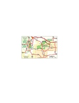
Datei:NPS badlands-regional-map.jpg

Größe dieser Vorschau: 800 × 497 Pixel. Weitere Auflösungen: 320 × 199 Pixel | 640 × 397 Pixel | 1.161 × 721 Pixel
Originaldatei (1.161 × 721 Pixel, Dateigröße: 198 KB, MIME-Typ: image/jpeg)
Dateiversionen
Klicke auf einen Zeitpunkt, um diese Version zu laden.
| Version vom | Vorschaubild | Maße | Benutzer | Kommentar | |
|---|---|---|---|---|---|
| aktuell | 12:59, 16. Mai 2017 |  | 1.161 × 721 (198 KB) | RKBot | =={{int:filedesc}}== {{Information |description= {{en|1=Regional Badlands National Park map, showing the area roads and nearby parks like Mount Rushmore and Wind Cave.}} |date= 2013-11-10 |source= U.S. National Park Service (http://npmaps.com/wp-conten... |
Dateiverwendung
Die folgende Seite verwendet diese Datei:

