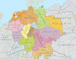
Datei:Bavaria locator map (1000).svg

Größe der PNG-Vorschau dieser SVG-Datei: 686 × 600 Pixel. Weitere aus SVG automatisch erzeugte PNG-Grafiken in verschiedenen Auflösungen: 275 × 240 Pixel | 549 × 480 Pixel | 878 × 768 Pixel | 1.171 × 1.024 Pixel | 2.342 × 2.048 Pixel | 4.431 × 3.875 Pixel
Originaldatei (SVG-Datei, Basisgröße: 4.431 × 3.875 Pixel, Dateigröße: 4,7 MB)
Dateiversionen
Klicke auf einen Zeitpunkt, um diese Version zu laden.
| Version vom | Vorschaubild | Maße | Benutzer | Kommentar | |
|---|---|---|---|---|---|
| aktuell | 17:16, 22. Mai 2016 |  | 4.431 × 3.875 (4,7 MB) | Alphathon | Changed colour of the Kingdom of Italy to reflect its inclusion in the Holy Roman Empire. Changed the colour of Silesian tributaries so as the not imply it was part of the Kingdom. Also changed colour of Rügen since it was neither in the Empire nor th... |
| 16:15, 18. Mai 2016 |  | 4.431 × 3.875 (4,7 MB) | Alphathon | == {{int:filedesc}} == {{Inkscape}} {{Information |Description={{en|A map of the en:Duchy of Bavaria (German: ''Herzogtum Bayern'') around the year 1000. The map is derived from a vectorised version of one found in Professor G. Droysens Allge... |
Dateiverwendung
Die folgenden 3 Seiten verwenden diese Datei:
Globale Dateiverwendung
Die nachfolgenden anderen Wikis verwenden diese Datei:
- Verwendung auf ar.wiki.x.io
- Verwendung auf bg.wiki.x.io
- Verwendung auf cs.wiki.x.io
- Verwendung auf da.wiki.x.io
- Verwendung auf en.wiki.x.io
- Verwendung auf es.wiki.x.io
- Verwendung auf fr.wiki.x.io
- Verwendung auf he.wiki.x.io
- Verwendung auf id.wiki.x.io
- Verwendung auf it.wiki.x.io
- Verwendung auf ko.wiki.x.io
- Verwendung auf ltg.wiki.x.io
- Verwendung auf mk.wiki.x.io
- Verwendung auf sh.wiki.x.io
- Verwendung auf simple.wiki.x.io
- Verwendung auf tr.wiki.x.io
- Verwendung auf vi.wiki.x.io
- Verwendung auf zh.wiki.x.io


