Datei:China Heilongjiang relief location map.png

Größe dieser Vorschau: 540 × 600 Pixel. Weitere Auflösungen: 216 × 240 Pixel | 432 × 480 Pixel | 691 × 768 Pixel | 922 × 1.024 Pixel | 2.000 × 2.222 Pixel
Originaldatei (2.000 × 2.222 Pixel, Dateigröße: 8,67 MB, MIME-Typ: image/png)
![]()
Diese Datei und die Informationen unter dem roten Trennstrich werden aus dem zentralen Medienarchiv Wikimedia Commons eingebunden.
![]()
| Beschreibung |
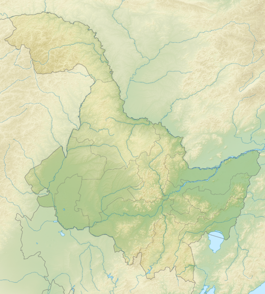
English: Location map of Heilongjiang, People's Republic of China Equirectangular projection, N/S stretching 141 %. True scale parallel: 45°00' N.
Geographic limits of the map:
|
| Datum | (UTC) |
| Quelle | |
| Urheber |
|
| Dieses Bild wurde digital nachbearbeitet. Das Originalbild kann hier eingesehen werden: China Heilongjiang location map.svg:
|
Ich, der Urheberrechtsinhaber dieses Werkes, veröffentliche es hiermit unter der folgenden Lizenz:
Diese Datei ist unter der Creative-Commons-Lizenz „Namensnennung – Weitergabe unter gleichen Bedingungen 3.0 nicht portiert“ lizenziert.
- Dieses Werk darf von dir
- verbreitet werden – vervielfältigt, verbreitet und öffentlich zugänglich gemacht werden
- neu zusammengestellt werden – abgewandelt und bearbeitet werden
- Zu den folgenden Bedingungen:
- Namensnennung – Du musst angemessene Urheber- und Rechteangaben machen, einen Link zur Lizenz beifügen und angeben, ob Änderungen vorgenommen wurden. Diese Angaben dürfen in jeder angemessenen Art und Weise gemacht werden, allerdings nicht so, dass der Eindruck entsteht, der Lizenzgeber unterstütze gerade dich oder deine Nutzung besonders.
- Weitergabe unter gleichen Bedingungen – Wenn du das Material wiedermischst, transformierst oder darauf aufbaust, musst du deine Beiträge unter der gleichen oder einer kompatiblen Lizenz wie das Original verbreiten.

|
Es ist erlaubt, die Datei unter den Bedingungen der GNU-Lizenz für freie Dokumentation, Version 1.2 oder einer späteren Version, veröffentlicht von der Free Software Foundation, zu kopieren, zu verbreiten und/oder zu modifizieren; es gibt keine unveränderlichen Abschnitte, keinen vorderen und keinen hinteren Umschlagtext.
Der vollständige Text der Lizenz ist im Kapitel GNU-Lizenz für freie Dokumentation verfügbar. |
Du darfst es unter einer der obigen Lizenzen deiner Wahl verwenden.
Ursprüngliches Datei-Logbuch
This image is a derivative work of the following images:
- File:China_Heilongjiang_location_map.svg licensed with Cc-by-sa-3.0, GFDL
- 2011-02-23T13:17:55Z Das steinerne Herz 260x289 (371882 Bytes) {{Information |Description ={{en|1=Heilongjiang_location_map}} |Source ={{own}} |Author =[[User:Das steinerne Herz|Das steinerne Herz]] |Date =2011-02-23 |Permission = |other_versions = }} [[
Hochgeladen mit derivativeFX
Dateiversionen
Klicke auf einen Zeitpunkt, um diese Version zu laden.
| Version vom | Vorschaubild | Maße | Benutzer | Kommentar | |
|---|---|---|---|---|---|
| aktuell | 19:32, 24. Feb. 2011 | | 2.000 × 2.222 (8,67 MB) | Das steinerne Herz | {{Information |Description={{en|1=Location map of Heilongjiang, People's Republic of China Equirectangular projection, N/S stretching 141 %. True scale parallel: 45°00' N. Geographic limits of the |
Dateiverwendung
Die folgenden 4 Seiten verwenden diese Datei:
Globale Dateiverwendung
Die nachfolgenden anderen Wikis verwenden diese Datei:
- Verwendung auf ba.wiki.x.io
- Verwendung auf bn.wiki.x.io
- Verwendung auf cs.wiki.x.io
- Verwendung auf cv.wiki.x.io
- Verwendung auf en.wiki.x.io
- Lake Khanka
- Mudanjiang
- Jingpo Lake
- Diaoshuilou Falls
- Lesser Khingan
- Module:Location map/data/China Heilongjiang/doc
- Module:Location map/data/China Heilongjiang
- Module:Location map/data/Heilongjiang
- User:Ty654/List of earthquakes from 2000-present exceeding magnitude 7+
- User:Ty654/List of earthquakes from 1940-1949 exceeding magnitude 6+
- User:Ty654/List of earthquakes from 1955-1959 exceeding magnitude 6+
- User:Ty654/List of earthquakes from 1980-1984 exceeding magnitude 6+
- User:Ty654/List of earthquakes from 2000-2004 exceeding magnitude 6+
- Zhangguangcai Range
- Northeast China Tiger and Leopard National Park
- Verwendung auf es.wiki.x.io
- Verwendung auf fa.wiki.x.io
- Verwendung auf fr.wiki.x.io
- Verwendung auf he.wiki.x.io
- Verwendung auf hu.wiki.x.io
- Verwendung auf ja.wiki.x.io
- Verwendung auf ko.wiki.x.io
- Verwendung auf lv.wiki.x.io
- Verwendung auf mn.wiki.x.io
- Verwendung auf os.wiki.x.io
- Verwendung auf pl.wiki.x.io
Weitere globale Verwendungen dieser Datei anschauen.