Datei:Western Reserve Including the Fire Lands 1826.jpg

Größe dieser Vorschau: 787 × 600 Pixel. Weitere Auflösungen: 315 × 240 Pixel | 630 × 480 Pixel | 1.008 × 768 Pixel | 1.280 × 975 Pixel | 2.560 × 1.950 Pixel | 6.112 × 4.656 Pixel
Originaldatei (6.112 × 4.656 Pixel, Dateigröße: 4,66 MB, MIME-Typ: image/jpeg)
![]()
Diese Datei und die Informationen unter dem roten Trennstrich werden aus dem zentralen Medienarchiv Wikimedia Commons eingebunden.
![]()
| Beschreibung |
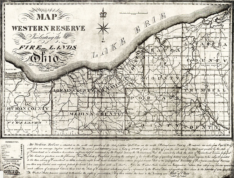
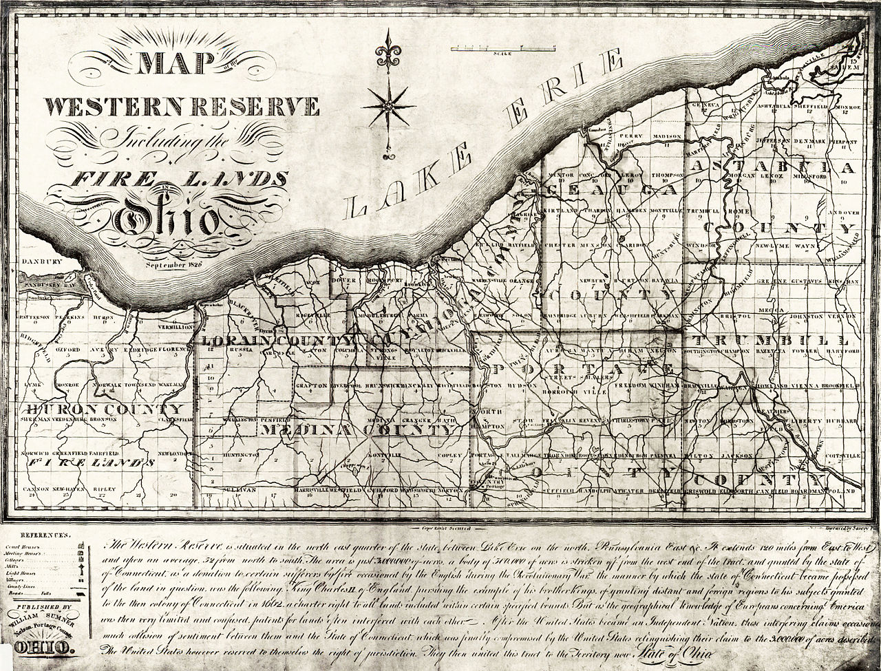
English: Map of the Connecticut Western Reserve in Ohio |
| Datum | |
| Quelle | Cleveland Public Library |
| Urheber | Published by William Sumner |
| Andere Versionen |

.jpg)
|
Dieses Werk ist gemeinfrei, weil seine urheberrechtliche Schutzfrist abgelaufen ist. | |
| Es wurde festgestellt, dass diese Datei frei von bekannten Beschränkungen durch das Urheberrecht ist, alle verbundenen und verwandten Rechte eingeschlossen. | |
Dateiversionen
Klicke auf einen Zeitpunkt, um diese Version zu laden.
| Version vom | Vorschaubild | Maße | Benutzer | Kommentar | |
|---|---|---|---|---|---|
| aktuell | 21:45, 22. Aug. 2010 | | 6.112 × 4.656 (4,66 MB) | Ras67 | losslessly cropped with Jpegcrop |
| 00:39, 24. Mär. 2008 |  | 6.569 × 5.088 (5,13 MB) | XcepticZP | Put back the "old color". Removed some age artifacts, but no pertinent detail was lost. | |
| 15:46, 16. Mär. 2008 |  | 6.569 × 5.088 (2,93 MB) | XcepticZP | Lightened up the image so the details can be seen. Removed yellow coloring. | |
| 22:58, 10. Mai 2007 |  | 6.569 × 5.088 (4,89 MB) | EurekaLott | 1826 map of the Connecticut Western Reserve in Ohio Image via the Cleveland Public Library {{PD-old}} Category:Maps of Ohio Category:Old maps of the United States |
Dateiverwendung
Die folgende Seite verwendet diese Datei:
Globale Dateiverwendung
Die nachfolgenden anderen Wikis verwenden diese Datei:
- Verwendung auf da.wiki.x.io
- Verwendung auf en.wiki.x.io
- Verwendung auf en.wiktionary.org
- Verwendung auf fr.wiki.x.io
- Verwendung auf it.wiki.x.io
- Verwendung auf ja.wiki.x.io
- Verwendung auf pl.wiki.x.io
- Verwendung auf ru.wiki.x.io
- Verwendung auf sv.wiki.x.io
- Verwendung auf th.wiki.x.io
- Verwendung auf www.wikidata.org
- Verwendung auf zh.wiki.x.io