Mubaa
osttimoresischer Ort im Suco Goulolo (Verwaltungsamt Cailaco, Gemeinde Bobonaro)
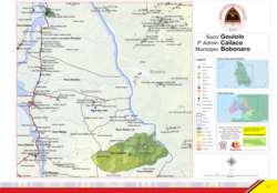
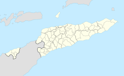
Mubaa ist ein osttimoresischer Ort im Suco Goulolo (Verwaltungsamt Cailaco, Gemeinde Bobonaro).[1][2]
| Mubaa | ||
|---|---|---|
|
| ||
| Koordinaten | 8° 56′ S, 125° 18′ O | |
 Der Suco Goulolo | ||
| Basisdaten | ||
| Staat | Osttimor | |
| Gemeinde | Bobonaro | |
| Verwaltungsamt | Cailaco | |
| ISO 3166-2 | TL-BO | |
| Suco | Goulolo | |
| Höhe | 496 m | |
Die kleine Siedlung liegt im Süden des Sucos auf einer Meereshöhe von 496 m. Der Ort liegt am Rand eines Steilhangs, der nach Süden etwa 150 m hinab zum Boroulo abfällt, einem Nebenfluss des Marobos. Westlich erhebt sich der Foho Oholau (536 m). Nordwestlich liegt der kleine See Foho Suriubu.[1]
Einzelnachweise
Bearbeiten- ↑ a b Timor-Leste GIS-Portal ( vom 30. Juni 2007 im Internet Archive)
- ↑ Direcção-Geral de Estatística: Atlas der Gemeinde Bobonaro, abgerufen am 25. September 2022.
