Liste der Countys in Ohio
Wikimedia-Liste
Der US-Bundesstaat Ohio ist in 88 Countys unterteilt. Sie werden im Folgenden mit ihrem County Seat (Kreisstadt), dem Gründungsdatum und dem Namensgeber aufgeführt. Die Spalte „Ursprung“ gibt an, aus welchen anderen Countys ein Neues entstand.
| County | FIPS Code [1] |
County Seat [2] |
Gegründet [2][3] |
Ursprung [4] |
Namensherkunft [3][4][5] |
Bevölkerung [1][2] |
Fläche [2] |
Karte |
|---|---|---|---|---|---|---|---|---|
| Adams County | 001 | West Union | 10. Juli 1797 | Hamilton County | John Adams (1735–1826), President zur Zeit der Gründung des Countys | 27.330 | 1.512 km² (583,91 sq mi) | 
|
| Allen County | 003 | Lima | 1. März 1820 | Shelby County | John Allen (1771/1772–1813), Soldat im Britisch-Amerikanischen Krieg[6] | 108.473 | 1.047 km² (404,43 sq mi) | 
|
| Ashland County | 005 | Ashland | 24. Februar 1846 | Wayne, Richland, Huron, und Lorain Countys | Ashland, Heimat von Henry Clay. | 52.523 | 1.099 km² (424,37 sq mi) | 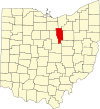
|
| Ashtabula County | 007 | Jefferson | 7. Juni 1807 | Trumbull und Geauga Countys | Ashtabula River, das „Fisch-Fluss“ in Algonquianisch bedeutet[7] | 102.728 | 1.819 km² (702,44 sq mi) | 
|
| Athens County | 009 | Athens | 1. März 1805 | Washington County | Athen | 62.223 | 1.313 km² (506,76 sq mi) | 
|
| Auglaize County | 011 | Wapakoneta | 14. Februar 1848 | Allen, Mercer, Darke, Hardin, Logan, Shelby, und Van Wert Countys | Auglaize River, das bei den Shawnee „Fluss der gefallenen Bäume“ bedeutet | 46.611 | 1.039 km² (401,25 sq mi) | 
|
| Belmont County | 013 | St. Clairsville | 7. September 1801 | Jefferson und Washington Countys | Belle monte, französisch für „Schöner Berg“ | 70.226 | 1.392 km² (537,35 sq mi) | 
|
| Brown County | 015 | Georgetown | 1. März 1818 | Adams und Clermont Countys | General Jacob Brown (1775–1828), Offizier im Britisch-Amerikanischen Krieg | 42.285 | 1.274 km² (491,76 sq mi) | 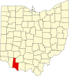
|
| Butler County | 017 | Hamilton | 1. Mai 1803 | Hamilton County | General Richard Butler (1743–1791), getötet in der Schlacht von Wabash | 332.807 | 1.210 km² (467,27 sq mi) | 
|
| Carroll County | 019 | Carrollton | 1. Januar 1833 | Columbiana, Stark, Harrison, Jefferson, und Tuscarawas Countys | Charles Carroll (1737–1832), letzter überlebender Unterzeichner der Unabhängigkeitserklärung | 28.836 | 1.022 km² (394,67 sq mi) | 
|
| Champaign County | 021 | Urbana | 1. März 1805 | Greene und Franklin Countys | Französisch für „Ebene“ als Beschreibung des Gebiets | 38.890 | 1.110 km² (428,56 sq mi) | 
|
| Clark County | 023 | Springfield | 1. März 1818 | Champaign, Madison, und Greene Countys | General George Rogers Clark (1752–1818), der die Shawnee-Indianer bei Springfield besiegte | 144.742 | 1.036 km² (399,86 sq mi) | 
|
| Clermont County | 025 | Batavia | 6. Dezember 1800 | Hamilton County | Französisch für „freier Berg“ | 177.977 | 1.171 km² (451,99 sq mi) | 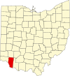
|
| Clinton County | 027 | Wilmington | 1. März 1810 | Highland und Warren Countys | George Clinton (1739–1812), Vizepräsident zur Zeit der Countygründung | 40.543 | 1.064 km² (410,88 sq mi) | 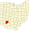
|
| Columbiana County | 029 | Lisbon | 1. Mai 1803 | Jefferson und Washington Countys | Abgeleitet von den Namen Christoph Columbus und Anna | 112.075 | 1.379 km² (532,46 sq mi) | 
|
| Coshocton County | 031 | Coshocton | 31. Januar 1810 | Muskingum und Tuscarawas Countys | „Vereinigung der Wasser“ in der Sprache der Delaware-Indianer | 36.655 | 1.461 km² (564,07 sq mi) | 
|
| Crawford County | 033 | Bucyrus | 1. April, 1820 | Delaware County | Offizier William Crawford (1732–1782) | 46.966 | 1.041 km² (402,11 sq mi) | 
|
| Cuyahoga County | 035 | Cleveland | 7. Juni 1807 | Geauga County | Cuyahoga River, das „Krummer Fluss“ auf Irokesisch bedeutet[8] | 1.393.978 | 1.187 km² (458,49 sq mi) | 
|
| Darke County | 037 | Greenville | 3. Januar 1809 | Miami County | General William Darke (1736–1801), Offizier im Unabhängigkeitskrieg | 53.309 | 1.553 km² (599,80 sq mi) | 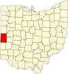
|
| Defiance County | 039 | Defiance | 7. April 1845 | Williams, Henry, und Paulding Countys | Fort Defiance, von Anthony Wayne 1794 errichtet | 39.500 | 1.065 km² (411,16 sq mi) | 
|
| Delaware County | 041 | Delaware | 1. April 1808 | Franklin County | Delaware-Indianer | 110.106 | 1.146 km² (442,41 sq mi) | 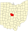
|
| Erie County | 043 | Sandusky | March 15, 1838 | Huron und Sandusky Countys | Erie-Indianer | 79.551 | 660 km² (254,88 sq mi) | 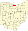
|
| Fairfield County | 045 | Lancaster | 9. Dezember 1800 | Ross und Washington Countys | Benannt nach den „schönen Feldern“ | 122.759 | 1.308 km² (505,11 sq mi) | 
|
| Fayette County | 047 | Washington Court House | 1. März 1810 | Ross und Highland Countys | Marquis de Lafayette, französischer Offizier und Aristokrat | 28.433 | 1.053 km² (406,58 sq mi) | 
|
| Franklin County | 049 | Columbus | 30. April 1803 | Ross und Wayne Countys | Benjamin Franklin (1706–1791) | 1.068.978 | 1.398 km² (539,87 sq mi) | 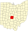
|
| Fulton County | 051 | Wauseon | 1. April 1850 | Lucas, Henry, und Williams Countys | Robert Fulton (1765–1815), Erfinder des Dampfschiffs | 42.084 | 1.054 km² (406,78 sq mi) | 
|
| Gallia County | 053 | Gallipolis | 30. April 1803 | Washington und Adams Countys | Gallien | 31.069 | 1.214 km² (468,78 sq mi) | 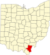
|
| Geauga County | 055 | Chardon | 1. März 1806 | Trumbull County | Ein Wort der Indianer für Waschbär | 90.895 | 1.045 km² (403,66 sq mi) | 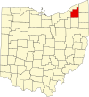
|
| Greene County | 057 | Xenia | 1. Mai 1803 | Hamilton und Ross Countys | General Nathanael Greene (1742–1786), Offizier im Unabhängigkeitskrieg | 147.886 | 1.075 km² (414,88 sq mi) | 
|
| Guernsey County | 059 | Cambridge | 1. März 1810 | Belmont und Muskingum Countys | Guernsey | 40.792 | 1.352 km² (521,90 sq mi) | 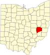
|
| Hamilton County | 061 | Cincinnati | 2. Januar 1790 | Eines der ursprünglichen Countys | Alexander Hamilton (1755/1757–1804) | 845.303 | 1.055 km² (407,36 sq mi) | 
|
| Hancock County | 063 | Findlay | 1. April 1820 | Logan County | John Hancock (1737–1793) | 71.295 | 1.376 km² (531,35 sq mi) | 
|
| Hardin County | 065 | Kenton | 1. April 1820 | Logan County | General John Hardin (Offizier) (1753–1792) | 31.945 | 1.218 km² (470,29 sq mi) | 
|
| Harrison County | 067 | Cadiz | 1. Februar 1813 | Jefferson und Tuscarawas Countys | General William H. Harrison (1773–1841) | 15.856 | 1.045 km² (403,53 sq mi) | 
|
| Henry County | 069 | Napoleon | 1. April 1820 | Shelby County | Patrick Henry (1736–1799) | 29.210 | 1.079 km² (416,50 sq mi) | 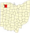
|
| Highland County | 071 | Hillsboro | 1. Mai 1805 | Ross, Adams, und Clermont Countys | Beschreibung der Landschaft | 40.875 | 1.433 km² (553,28 sq mi) | 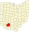
|
| Hocking County | 073 | Logan | 1. März 1818 | Athens, Ross, und Fairfield Countys | Eventuell vom Wort der Delaware-Indianer „Hoch-Hoch-ing“, das „Flasche“ bedeutet | 28.241 | 1.095 km² (422,75 sq mi) | 
|
| Holmes County | 075 | Millersburg | 20. Januar 1824 | Coshocton, Wayne, und Tuscarawas Countys | Major Andrew Holmes († 1814) | 38.943 | 1.096 km² (422,99 sq mi) | 
|
| Huron County | 077 | Norwalk | 7. März 1809 | Portage und Cuyahoga Countys | Huron-Indianer | 59.847 | 1.276 km² (492,69 sq mi) | 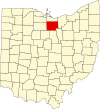
|
| Jackson County | 079 | Jackson | 1. März 1816 | Scioto, Gallia, Athens, und Ross Countys | General Andrew Jackson (1767–1845) | 32.641 | 1.089 km² (420,28 sq mi) | 
|
| Jefferson County | 081 | Steubenville | 29. Juli 1797 | Washington County | Thomas Jefferson (1743–1826) | 73.894 | 1.061 km² (409,61 sq mi) | 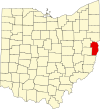
|
| Knox County | 083 | Mount Vernon | 1. März 1808 | Fairfield County | General Henry Knox | 54.500 | 1.365 km² (527,12 sq mi) | 
|
| Lake County | 085 | Painesville | 6. März 1840 | Geauga und Cuyahoga Countys | An den Ufern des Eriesees | 227.511 | 591 km² (228,21 sq mi) | 
|
| Lawrence County | 087 | Ironton | 21. Dezember 1815 | Gallia und Scioto Countys | Captain James Lawrence (1781–1813) | 62.319 | 1.178 km² (454,96 sq mi) | 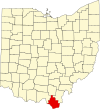
|
| Licking County | 089 | Newark | 1. März 1808 | Fairfield County | Nach den Salzlecken im County benannt | 145.491 | 1.778 km² (686,50 sq mi) | 
|
| Logan County | 091 | Bellefontaine | 1. März 1818 | Champaign County | General Benjamin Logan (~1742–1802) | 46.005 | 1.187 km² (458,44 sq mi) | 
|
| Lorain County | 093 | Elyria | 26. Dezember 1822 | Huron, Cuyahoga, und Medina Countys | Nach Lorraine in Frankreich | 284.664 | 1.276 km² (492,50 sq mi) | 
|
| Lucas County | 095 | Toledo | 20. Juni 1835 | Wood, Sandusky, und Huron Countys | Robert Lucas (1781–1853), Gouverneur von Ohio | 455.054 | 882 km² (340,46 sq mi) | 
|
| Madison County | 097 | London | 1. März 1810 | Franklin County | President James Madison (1751–1836) | 40.213 | 1.205 km² (465,44 sq mi) | 
|
| Mahoning County | 099 | Youngstown | 1. März 1846 | Columbiana und Trumbull Countys | Mahoning River | 257.555 | 1.075 km² (415,25 sq mi) | 
|
| Marion County | 101 | Marion | 1. April 1820 | Delaware County | General Francis Marion (1732–1795) | 66.217 | 1.046 km² (403,84 sq mi) | 
|
| Medina County | 103 | Medina | 18. Februar 1812 | Portage County | Medina, Hauptstadt von Al Madinah in Saudi-Arabien | 151.095 | 1.092 km² (421,55 sq mi) | 
|
| Meigs County | 105 | Pomeroy | 1. April 1819 | Gallia und Athens Countys | Return Jonathan Meigs Jr. (1764–1825) | 23.072 | 1.112 km² (429,42 sq mi) | 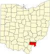
|
| Mercer County | 107 | Celina | 1. April 1820 | Darke County | General Hugh Mercer (1726–1777) | 40.924 | 1.200 km² (463,27 sq mi) | 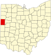
|
| Miami County | 109 | Troy | 1. März 1807 | Montgomery County | Miami-Indianer | 98.868 | 1.054 km² (407,04 sq mi) | 
|
| Monroe County | 111 | Woodsfield | 29. Januar 1813 | Belmont, Washington, und Guernsey Countys | James Monroe (1758–1831) | 15.180 | 1.180 km² (455,54 sq mi) | 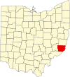
|
| Montgomery County | 113 | Dayton | 1. Mai 1803 | Hamilton und Wayne Countys | General Richard Montgomery (1738–1775) | 559.062 | 1.196 km² (461,68 sq mi) | 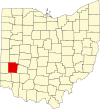
|
| Morgan County | 115 | McConnelsville | 29. Dezember 1817 | Washington, Guernsey, und Muskingum Countys | General Daniel Morgan (c.1735–1802) | 14.897 | 1.082 km² (417,66 sq mi) | 
|
| Morrow County | 117 | Mount Gilead | 1. März 1848 | Knox, Marion, Delaware, und Richland Countys | Jeremiah Morrow (1771–1852), Gouverneur von Ohio | 31.628 | 1.052 km² (406,22 sq mi) | 
|
| Muskingum County | 119 | Zanesville | 1. März 1803 | Washington und Fairfield Countys | Ein einheimisches Wort für „Dorf am Fluss“ oder ein einheimisches Wort für „am Fluss“ |
84.585 | 1.721 km² (664,63 sq mi) | 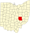
|
| Noble County | 121 | Caldwell | 1. April 1851 | Monroe, Washington, Morgan, und Guernsey Countys | John Noble (1785–1831), ein früher Siedler | 14.058 | 1.033 km² (399,00 sq mi) | 
|
| Ottawa County | 123 | Port Clinton | 6. März 1840 | Erie, Sandusky, und Lucas Countys | Ottawa-Indianer | 40.985 | 660 km² (254,95 sq mi) | 
|
| Paulding County | 125 | Paulding | 1. April 1820 | Darke County | John Paulding (1758–1818) | 20.293 | 1.078 km² (416,26 sq mi) | 
|
| Perry County | 127 | New Lexington | 1. März 1818 | Washington, Fairfield, und Muskingum Countys | Commodore Oliver Hazard Perry (1785–1819) | 34.078 | 1.061 km² (409,78 sq mi) | 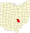
|
| Pickaway County | 129 | Circleville | 1. März 1810 | Ross, Fairfield, und Franklin Countys | Falschschreibung für den Piqua-Stamm oder Eine Ableitung des indianischen Wortes „Piqua“ |
52.727 | 1.300 km² (501,91 sq mi) | 
|
| Pike County | 131 | Waverly | 1. Februar 1815 | Ross, Scioto, und Adams Countys | General Zebulon Pike (1779–1813), Entdecker von Pikes Peak | 27.695 | 1.143 km² (441,49 sq mi) | 
|
| Portage County | 133 | Ravenna | 7. Juni 1807 | Trumbull County | Portage, Umtragen von Kanus über Land | 152.061 | 1.275 km² (492,39 sq mi) | 
|
| Preble County | 135 | Eaton | 1. März 1808 | Montgomery und Butler Countys | Captain Edward Preble (1761–1807) | 42.337 | 1.100 km² (424,80 sq mi) | 
|
| Putnam County | 137 | Ottawa | 1. April 1820 | Shelby County | General Israel Putnam (1718–1790), Offizier im Unabhängigkeitskrieg | 34.726 | 1.253 km² (483,87 sq mi) | 
|
| Richland County | 139 | Mansfield | 1. März 1808 | Fairfield County | Beschreibung des Bodens in dieser Gegend | 128.852 | 1.287 km² (496,88 sq mi) | 
|
| Ross County | 141 | Chillicothe | 20. August 1798 | Adams und Washington Countys | James Ross | 73.345 | 1.783 km² (688,41 sq mi) | 
|
| Sandusky County | 143 | Fremont | 1. April 1820 | Huron County | Ein Wort der Irokesen für „kaltes Wasser“ | 61.792 | 1.060 km² (409,18 sq mi) | 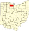
|
| Scioto County | 145 | Portsmouth | 1. Mai 1803 | Adams County | Scioto River; Das Wort bedeutet „Hirsch“ in der Sprache der Wyandot | 79.195 | 1.586 km² (612,27 sq mi) | 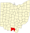
|
| Seneca County | 147 | Tiffin | 1. April 1820 | Huron County | Seneca-Indianer, welche hier lebten | 58.683 | 1.426 km² (550,59 sq mi) | 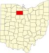
|
| Shelby County | 149 | Sidney | 1. April 1819 | Miami County | General Isaac Shelby (1750–1826) | 47.910 | 1.060 km² (409,27 sq mi) | 
|
| Stark County | 151 | Canton | 13. Februar 1808 | Columbiana County | General John Stark (1728–1822) | 378.098 | 1.492 km² (576,14 sq mi) | 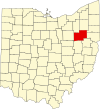
|
| Summit County | 153 | Akron | 3. März 1840 | Medina, Portage, und Stark Countys | Weil hier der Ohio-Kanal seine höchste Stelle erreicht | 542.899 | 1.069 km² (412,72 sq mi) | 
|
| Trumbull County | 155 | Warren | 10. Juli 1800 | Jefferson und Wayne Countys | Jonathan Trumbull senior (1710–1785), Gouverneur von Connecticut | 225.116 | 1.597 km² (616,48 sq mi) | 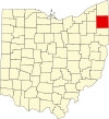
|
| Tuscarawas County | 157 | New Philadelphia | 15. März 1808 | Muskingum County | Tuscarawas River, „Fluss des offenen Mundes“ oder Tuscarawas-Stamm |
90.914 | 1.470 km² (567,58 sq mi) | 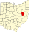
|
| Union County | 159 | Marysville | 1. April 1820 | Delaware, Franklin, Logan, und Madison Countys | So genannt, weil es aus vier anderen Countys vereinigt wurde | 40.909 | 1.131 km² (436,65 sq mi) | 
|
| Van Wert County | 161 | Van Wert | 1. April 1820 | Darke County | Isaac Van Wart (1760–1828), der den Spion John André während des Amerikanischen Unabhängigkeitskrieges festnahm | 29.659 | 1.062 km² (410,09 sq mi) | 
|
| Vinton County | 163 | McArthur | 23. März 1850 | Athens, Gallia, Hocking, Jackson, und Ross Countys | Samuel Finley Vinton (1792–1862) | 12.806 | 1.072 km² (414,08 sq mi) | 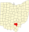
|
| Warren County | 165 | Lebanon | 1. Mai 1803 | Hamilton County | General Joseph Warren (1741–1775), Offizier im Amerikanischen Unabhängigkeitskrieg | 158.383 | 1.035 km² (399,63 sq mi) | 
|
| Washington County | 167 | Marietta | 27. Juli 1788 | Eines der ursprünglichen Countys | George Washington (1732–1799) | 63.251 | 1.645 km² (635,15 sq mi) | 
|
| Wayne County | 169 | Wooster | 1. März 1808 | Aus noch nicht zugeteiltem Gebiet | General Anthony Wayne (1745–1796), Offizier im Unabhängigkeitskrieg | 111.564 | 1.438 km² (555,36 sq mi) | 
|
| Williams County | 171 | Bryan | 1. April 1820 | Darke County | David Williams (1754–1831) | 39.188 | 1.092 km² (421,74 sq mi) | 
|
| Wood County | 173 | Bowling Green | 1. April 1820 | Aus noch nicht zugeteiltem Gebiet | Eleazer D. Wood (1783–1814), Gründer von Fort Meigs | 121.065 | 1.599 km² (617,32 sq mi) | 
|
| Wyandot County | 175 | Upper Sandusky | 3. Februar 1845 | Marion, Crawford, und Hardin Countys | Wyandot-Indianer | 22.908 | 1.051 km² (405,61 sq mi) | 
|
Einzelnachweise
Bearbeiten- ↑ a b EPA County FIPS Code Listing. EPA, abgerufen am 9. April 2007.
- ↑ a b c d NACo – Find a County. Archiviert vom am 12. Juli 2008; abgerufen am 22. Juli 2007.
- ↑ a b Federal Roster: Counties of Ohio, Derivation of Name and Date of Erection. Archiviert vom am 28. Februar 2008; abgerufen am 22. Juli 2007.
- ↑ a b Ohio Genealogy Clickable County Map. Archiviert vom am 9. Juni 2008; abgerufen am 25. Juli 2007. [nicht mehr verfügbar]
- ↑ The origin of Ohio's country names. rootsweb, abgerufen am 22. März 2009.
- ↑ Resolution of 111th Ohio General Assembly designating John Allen as the person for which Allen County was named
- ↑ Ashtabula, Encyclopædia Britannica, 2007. Abgerufen am 19. November 2007
- ↑ Cuyahoga River, Encyclopædia Britannica, 2007. Abgerufen am 19. November 2007
